An ascent of Cordoba's highest mountain, linking the Traslasierra Valley with the Calamuchita Valley
A route that's infectious with adventure
The Sierras Grandes of Cordoba, or Sierras de los Comechingones, have always been a huge draw for hiking lovers. It's the highest summit in Cordoba province. 80% of ascents of the Champaqui are done via its eastern slope, from the Calamuchita Valley, generally starting from Villa Alpina. However, the routes that let you reach the upper ridge of the hills from the west, that is from Traslasierra, have a much more adventurous, special character, and the difficulty increases due to the large elevation gain to overcome (around 1500 m from the base).
In this case, the plan is to complete a beautiful traverse, linking the two valleys and, in the middle, reaching the province's highest summit, connecting the mountain village of Los Hornillos, very close to the La Vina Dam, with La Cumbrecita, the village that always brings to mind the Europe of the Swiss and Austrian Alps, very close to Villa General Belgrano, the end of the adventure.

Map:
In Red: The first day
In White: Second day
In Green: Third day
Purple and yellow: other routes from the west
Day 1: Meeting point in Los Hornillos, exact spot to be agreed. Gear check and departure for the first leg of the route. A significant climb into the hills that slowly reveals great views of the vast Traslasierra Valley, including the towns of Nono, Villa Las Rosas, Los Hornillos, Los Molles and the La Vina Dam. Once we reach the highest point of the route, we enter a flat area, even with some descent, until we reach the outpost and mountain refuge.
Starting elevation: 1000 masl
Maximum elevation: 2500 masl
Refuge elevation: 2300 masl
Net trekking hours: 10
Day 2: We'll dedicate this day to a loop route, including ascents of Cerro de la Totora, the Champaqui, and other peaks on the range's summit circuit. We'll see the Champaqui's summit lagoon and enjoy the whole high-sierra area; possible condor sightings. Return to the refuge via the base and an area with numerous classic refuges. Rest and a farewell dinner in the mountains, at the refuge.
Starting and ending elevation: 2300 masl
Maximum elevation (Champaqui summit): 2780 masl
Trekking hours: 5
Day 3: We'll cross a long stretch of the large flat area known as PAMPA DE ACHALA, with high-altitude vegetation and striking geological formations with rocks combining mica, feldspar and quartz (granite). We'll then begin a descent through a valley toward the La Cumbrecita area. Along the way we'll visit some waterfalls and get other great views of the region. Pine forests, more fertile valleys and numerous streams fill the landscape. We finally reach the beautiful village of La Cumbrecita. Transfer to Villa General Belgrano. End of the route and of our services.
Starting elevation: 2300 masl
Maximum elevation: 2500 masl
Final elevation (La Cumbrecita): 1350 masl
Net trekking hours: 10

Two nights at the mountain refuge; you need to bring a sleeping bag and a sleeping pad.
No. It's important to have some experience hiking with an expedition backpack (a large trekking pack, over 60 liters).
The first day is the most demanding, since we climb for 10 hours to the campsite next to a refuge.
The meeting point is in Los Hornillos, exact spot to be set in advance with the guide. And it ends in La Cumbrecita. It's possible to travel by bus both ways. Or fly to Cordoba and take a bus from there.
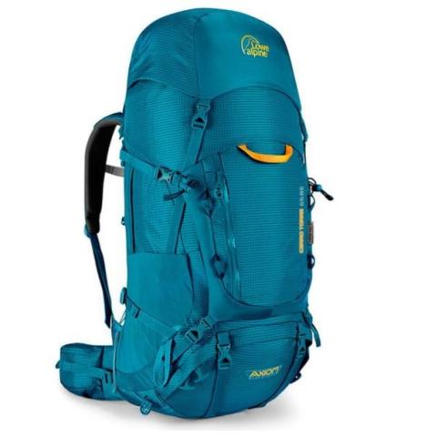
There's a section where you can see what you need to bring. A 60 to 80-liter trekking/expedition backpack, trekking shoes, a sleeping bag and a third-layer parka jacket are the main items.
Trek from Los Hornillos to La Cumbrecita + Champaqui Summit is an expedition that any adventurer can take on with the right physical preparation, equipment and prior experience con salida desde Los Hornillos, Traslasierra, Cordoba , in the region center, Argentina. It lasts 3 days. Todos nuestros programas incluyen guías de montaña certificados, logística de expedición y seguro de accidentes personales.
Como medir la dificultad de un ascenso o una expedición? es una pregunta que surge a menudo. Para esto desarrollamos un sistema de graduación que ayuda al participante a medir la dificultad, dado a que evaluamos 5 variables sobre la intensidad de cada propuesta.
• The weight of the backpack relative to the length of the day
• The physical demand
• The technical level of the terrain and required equipment
• The degree of mental strength required
• The maximum altitude reached
Hace click el botón y evaluá vos mismo la dificultad ->:
En cada uno de nuestros programas vas encontrar un apartado de EQUIPO REQUERIDO. contá con nosotros para asesorarte y prepararlo de forma adecuada para maximizar el disfrute de la actividad. Contamos con una tienda de alquiler, para resolver si te falta algo.
Chequealo ahora! ->
Professionals: Certified Mountain Guides Camping - Lodging: 2 nights at a mountain refuge. Mountain Cuisine: 2 Breakfasts, 3 Lunches, 2 Afternoon Snacks, 2 Dinners + trail snacks. Safety: General first-aid kit. Guide with international WFR certification. Handheld radio Load carrying: with pack animals Adventurer assistance: Detailed guidance before the activity Informational meetings. Validation of the required equipment to make sure you're prepared 24/7 support on departure day
At AEX, the safety of our travelers and guides comes first. Activities are only suspended or modified when weather, political or geographic conditions put the expedition at risk. The decision rests exclusively with the guide team and technical direction, based on official reports (National Weather Service, National Parks or local authorities).
No. The amount paid becomes a Credit in your favor (Weather Voucher) valid for 18 months from the suspended date: up to 6 months to choose a new date plus 12 months to take part. You can use it for the same expedition or any of our other destinations and experiences, and if you cannot use it within that period you can transfer it to someone else.
Click on each indicator to see details
Backpack: Weight / Duration of the Day.
Physical demand
Technician: Difficulty in the Field / Equipment.
Psychological Strength
Height Exposure
Each aspect is evaluated from 20% to 100%, where:
Previous experience and good physical condition required.
COOKING
OPTIONAL, not mandatory (mind the space and weight)
Available
Available
Available
Available
Available
Available
Available
Available
147 Google reviews
Fui a Tres Picos con Mati y Fer de AEX. Todo sucedió como estaba organizado. Tanto los guías como Euge estuvieron disponibles desde el día 1 de la reserva para evacuar todas nuestras dudas y llegar de la mejor manera al trekking. Súper recomendable viajar con AEX.
Excelente servicio de principio a fin, te ayudan y acompañan en todo el proceso de preparación para tu salida y tienen los mejores guías, por servicio y calidad humana
Tilcara Calilegua es la travesía mas hermosa que hice, tiene unos paisajes maravillosos . La inmensidad en la montaña es increible. Pero lo que realmente lo hizo mágico fueron los lugares donde nos hospedamos, los compañeros de montaña y el amor y el cuidado de los guías. Euge y Gus estuvieron en cada detalle, pendiente de cada uno de nosotros, realemente ellos fueron el viaje. La comida increible. Agradecida eternamente con ambos..
If you have questions about this adventure, we look forward to hearing from you!
For an immediate response, contact us via WhatsApp 54 9 1170623800
We will respond to you promptly, so you can prepare for your next great adventure 🏔️