Seven steps. Just seven steps across that miserable scree slope, and the giant's summit ridge would finally flood our hungry eyes with reality. I look back at my faithful followers. Seven steps, I think.
A few days earlier, driving the roads of northern Neuquén, a wide bend in the road had opened the door to the view we were after. And there it was, crowned in glory, wrapped in solitude, on Patagonia's hidden roof and in the very home of the wind, the Domuyo Volcano. "El Domo" to its friends. The sacred temple of rock, sand, snow and ice that can be seen from the southern valleys of Varvarco, from the sheer canyon of the Atreuco and from the immeasurable, jagged line of the Andes.
The name Domuyo comes from Mapudungun and means "the one that shakes and grumbles". And yet, several days of work in its imposing, desolate kingdom aren't enough to hear any real shaking or grumbling. What you do come to sense, step by step, in the slow unfolding of the place, is an inescapable dose of peace and immeasurable timelessness. Today it's been established that calling it a volcano, geologically speaking, isn't quite accurate. It's simply part of a massif whose location happens to sit within a volcanic setting. 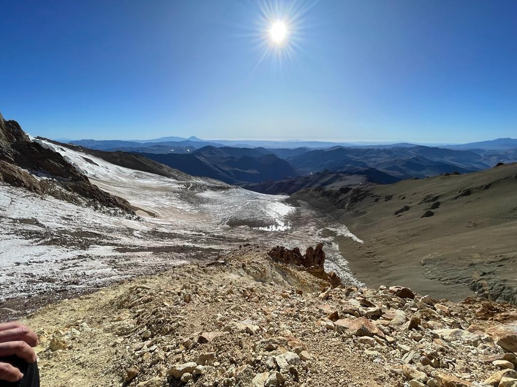 It sits on the edge of the Cordillera del Viento, in the north of Neuquén province, at the northernmost reaches of Patagonia. This massif belongs neither geologically nor geographically to the Andes, and it runs in a NNW - SSE direction. Millions of years ago, before the Andes themselves had even formed, the area now occupied by Domuyo lay entirely beneath the sea. Hence the marine fossils, ammonites, trilobites, algae and others, often found on its slopes. Eroded volcanic rock is the common thread running through the whole terrain and it makes for a singular challenge in crossing the long, snow-free scree slopes and exposed, jagged ridges.
Our climbing and expedition group, mixed and, on paper at least, a fairly mismatched bunch, was made up of a dozen adventurers hoping to make their long-awaited vacation unforgettable with a fresh foray into an unfamiliar and extremely rugged world. We, for our part, working to make those hopes a reality, were putting the finishing touches on every last detail.
-Off to the summit of dreamers, are you?- came the unexpected words from the weathered lips of a singular resident of Varvarco while we were finishing pitching our tents at the municipal campground -. For a moment I flashed back through my earlier climbs and realized I'd never once heard the stone giant called anything like that. I stared at the man, stunned and thoughtful, and as my memory kept slowly rewinding, I answered: "-Yes, why do you call it that?"- And in a single, irreproducible drop of silence, the sudden reveal of his two lone front teeth, peeking out from his weathered smile, became the last image burned into that Varvarco sunset.
Zapala is Neuquén's hub city par excellence. From there you can start heading north, passing through the towns of Chos-Malal, Andacollo, Las Ovejas and finally, Varvarco. To begin the hike into Domuyo's domain, you need to reach what's known as El Estacionamiento or El Playón, the last spot to leave vehicles. From Varvarco you continue along the route heading north toward Aguas Calientes. You travel through the wide valley between the Covunco stream and the upper Neuquén River, emerging at a place that grabs all your attention, the Cajón del Atreuco. From here begins a winding climb skirting some striking triangular rock formations. Finally, 3 Km. before the village of Aguas Calientes, a road opens to the right. This one, after several forks, leads to the lot mentioned above. The trek has begun.
Just a few meters into the hike, a small house appears on the left, Don Castillo's. If someone's home, you can hire a pack animal to carry your gear to base camp for very little money.
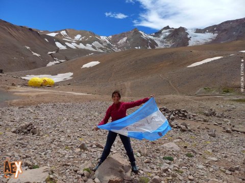
The trail, clearly visible and well marked, gradually drops down to the banks of the Covunco stream after crossing another stream flowing in from the west. Here there's a large rock that serves as a natural bridge to the far bank, the so-called Roca Gemela, which today has an actual bridge as well. On the other side, the track follows the watercourse's left bank as it climbs steadily deeper into the mountain. There you're met with the striking sight of the sheer south-southwest face. You pass through a small stretch of wetland meadows along the trail, and soon a series of striking lagoons begin appearing on either side of the path. Beside the last of these, an intense emerald color and at 3000 masl, sits Base Camp (some call it Camp 1).
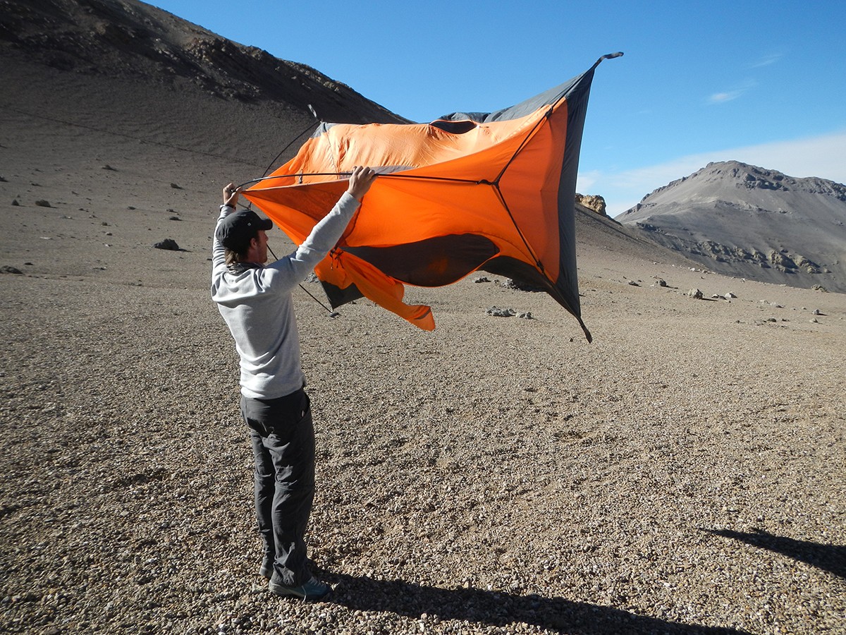 Making friends with the terrain step by step, the weather began giving us a certain stability and hinting at a very good outlook for the days ahead. The Cordillera del Viento doesn't easily give up its claim to that name. There are plenty of stories of unbearable windstorms that ended up flattening top-quality tents and burying the hopes of more than one expedition. This time luck seemed to be on our side, and we weren't about to let the chance slip by.
Base Camp sits right before the slope's grade shifts noticeably. There's a small tin-roofed shelter that can hold up to 4 people, though some time ago it was crushed by a major snowstorm. It's best to spend the night in tents, since the area has several stone-wall enclosures sturdy enough to help block the gusts.
Seven images of despair running along an endless ridge. A summit that never appears. I wake up anxious, sleep still clinging to my skin. It's the insomnia of the 3750 masl high camp, I tell myself, not entirely convinced. I lie back down, sigh and once more, trying to recapture that same unsettling scene, sink back into that defiant dream world.
Even though the trail is always well trodden, the terrain changes drastically once you leave base camp. The climb becomes noticeably steeper and steeper and your legs start to feel the mountain's real toll. First you climb onto a kind of long shelf and then traverse an extensive, rocky slope along the ridge where a few high camps are pitched. One last zigzagging stretch tops out onto the ridge itself. There's another camping area called De Los Hoyos, a bit lower down and to the west, used by some expeditions. The last spot with stone walls for pitching a tent, at nearly 4000 masl, is called La Montura but in reality it begins well before the 3750 masl mark, where we set up our high camp, the most sheltered spot in the area. Here the wind can do whatever it pleases once it's in a rage. Gusts strong enough to flip any tent, to see for yourself, all you have to do is step over to the restroom area on the other side of the ridge for a moment, where you also get some incredible sunset views.
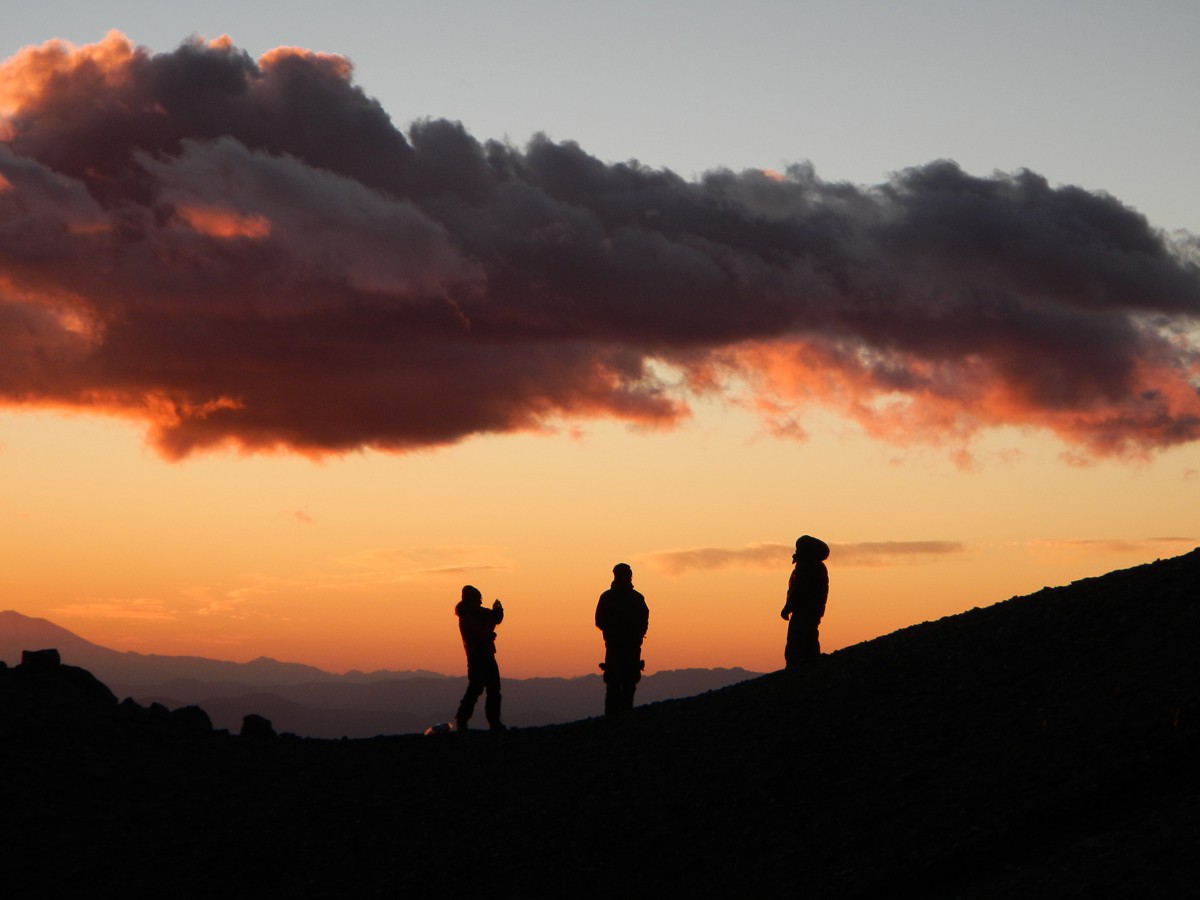
We pitched our five tents inside the four stone enclosures in the area and kept up with our hydration routine while we waited for the big day, the day of the climb. Dusk was already lending a note of optimism to what lay ahead. We stood outside the tents, picturing one more dream about to come true and taking in one of those views that truly raise the hair on your arms: the sun slipping behind the border peaks and turning the dark glacier red, the moon anticipating its majestic entrance and lighting up the vertical infinity.
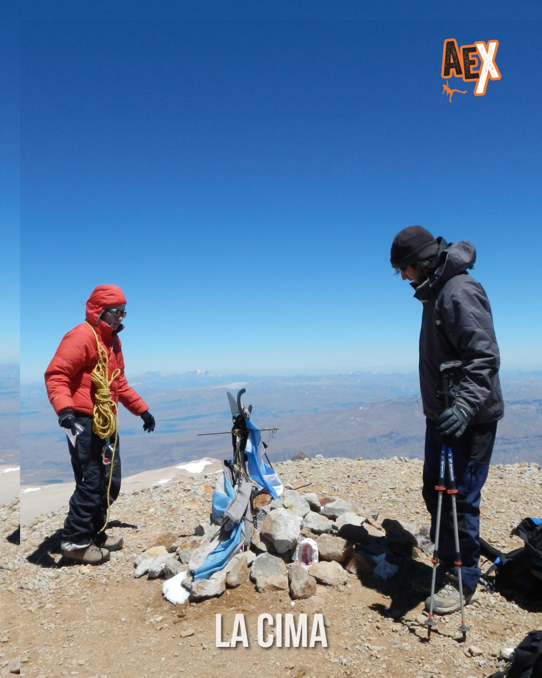
Seven of the twelve are already breathing summit air. The five remaining companions rest peacefully at the high camp, waiting for the others to return. And yet those resting, deeply moved, on the summit feel, savor and share that sublime moment with their peers. The glory belongs to everyone.
Picturing the decisive day of a mountain expedition with ideal temperatures and weather is probably one of the most common scenes in the hopes and dreams of mountaineers and explorers. That day, our summit push, along with every day before it, belonged to one of those hard-won chapters.
The trail keeps climbing up La Montura until it reaches the 4000 m.a.s.l. camp. There the path bends slightly to the left and traverses the final stretch up to the Portezuelo del Viento, sitting at about 4100 m.a.s.l. The view from the pass is overwhelming. You can make out the massive Chalileo Glacier melting its ice from the summit off toward the distant East, as well as nearly the entire route already covered and practically all of the route still ahead. There's also a plaque here for one of two young men who died at this very spot in the summer of 2004, from causes that remain unknown to this day.
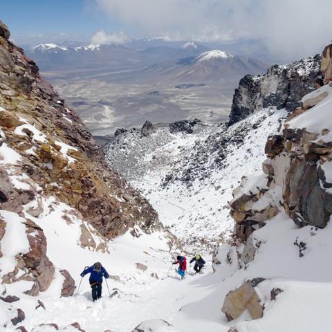
From here the route follows a fairly steep snowfield mixing patches of ice with penitentes, which in low-snow years is very tricky to cross. Before going on, we said goodbye to our companions, who had wisely decided to head back down to camp, guided by one of us. We strapped on our crampons, put on our glasses and, ice axe in hand, began the last long climb to the summit ridge.
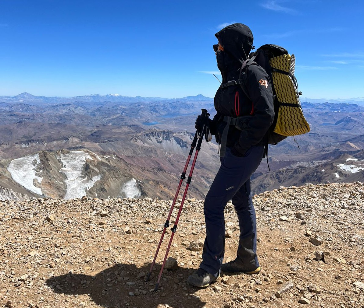 The grade stays considerable across most of the route, though hard snow and ice conditions make for a much lighter, easier walk. The scenery up there never stops delivering boundless grandeur. The Andes, that magnificent work of nature, that impenetrable line of geological processes, shines and shows off the best of its visual repertoire. To the west, a distant line of volcanoes fills the view: Cayaqui, Copahue, Llaima, Tromen, Lonquimay... To the north, the vast Payunia, the largest reserve of volcanoes in the world, already in Mendoza. To the east, the steppe with its endless horizons and arid Patagonia in all its splendor.
Seven lasting moments in seven days of loving Domuyo. Seven steps already taken. Now we can see it like never before. From the long-awaited false summit, just 15 happy minutes of walking away. The 4709 m.a.s.l. summit. The summit of dreamers. Maybe because it conjures images that feed unreachable dreams? Maybe because it deepens the insomnia along its lower, rocky ridges? Or maybe simply because it's the magical roof of that famed Patagonia everyone dreams of reaching someday? Recalling the old man's words on that unforgettable Varvarco afternoon, right there at the very origin of this climb, I came away convinced that, one way or another, any description tied to this colossal Patagonian volcano will always carry a mysterious, accumulated air of reverie. Because when the cross that crowns the summit makes its glorious appearance and when your last labored steps come to rest on that final breath of climbable ground, the feeling bursts and spills out over a blanket of unforgettable nature.